


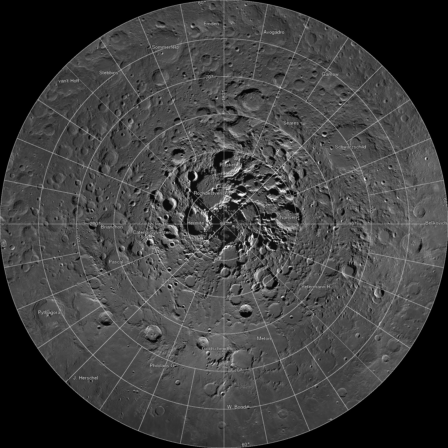
The LROC team assembled 10,581 NAC images, collected over 4 years, into a spectacular northern polar mosaic. The LROC Northern Polar Mosaic (LNPM) is likely one of the world’s largest image mosaics in existence, or at least publicly available on the web, with over 680 gigapixels of valid image data covering a region (2.54 million km2, 0.98 million miles2) slightly larger than the combined area of Alaska (1.72 million km2) and Texas (0.70 million km2) -- at a resolution of 2 meters per pixel! To create the mosaic, each LROC NAC image was map projected on a 30 m/pixel Lunar Orbiter Laser Altimeter (LOLA) derived Digital Terrain Model (DTM) using a software package called the Integrated Software for Imagers and Spectrometers (ISIS).
http://lroc.sese.asu.edu/news/index.php?/archives/874-681-Gigapixels!.html
Interactive super-high-res here: http://lroc.sese.asu.edu/gigapan/
It’s hard to put into perspective just how large this image is, and so NASA has kindly provided a few comparison images to help out. The first shows you how large of an area the mosaic covers:

In all, the piece of moon that NASA photographed would cover more than a quarter of the United States. That in and of itself isn’t that impressive until you find out that they photographed this are at a resolution of 2-meters per pixel!
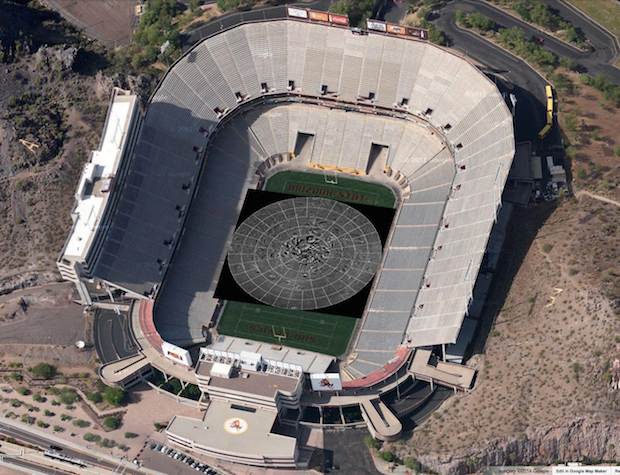
That’s enough resolution that if you printed this image — which, by the way, would weigh in at a crazy 3.3 terabytes if it was a single image file — at 300dpi, you would need a sheet of paper as wide as a football field and almost as long:
http://petapixel.com/2014/03/19/enor...i/#more-131749

 Reply With Quote